| Glasgow Digital Library | Voyage of the Scotia | BRUCE | PEOPLE | SHIP | ANTARCTIC | INDEX |
|---|
The wind on Laurie Island came mainly from the west and northwest, but the clear weather was associated with cold Antarctic air from the south. There were tremendous swings in the temperature. The lowest temperature for the winter was -40°C and the highest 8°C (on 31 May, three weeks before mid-winter's day, when rain fell). When the wind came over the mountains from the north a 'fohn effect' could result in a temperature rise of up to 20°C.

Although some survey work was done in the winter months, much was done in the spring. The place names on the map of Laurie Island are almost a list of the scientists and crew of Scotia. Scientists who had supported Bruce and those who sponsored him have their names given to bays, headlands and peninsulas. Bruce's wife and son also have features named after them. Many names on the map above have been omitted for clarity.

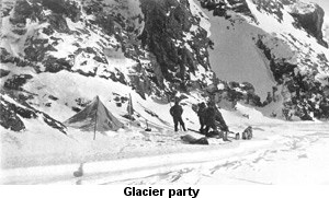
The northern side of the island was sometimes free of the pack ice in winter, but in the south Scotia Bay was icebound all winter - sometimes as far out as Ailsa Craig and around Cape Burn-Murdoch. Beyond Ailsa Craig a strip of water was almost always present. The ship's boats were also used for survey work, especially in the northern side of the island. The survey work usually took place using a sledge for carrying survey equipment and a pyramidal tent for shelter (with bamboo poles supporting the tent). Similar tents are used in the Antarctic today. The tents had a canvas tunnel as an entrance which could be tied up to keep the snow out. Dogs were used on some of the survey expeditions but Bruce only had a limited number with him.
Travelling on the ice floes could be hazardous, sometimes requiring jumping from floe to floe. On one occasion the surveying party was trapped on a floe for several days having to eat raw penguin flesh to survive.

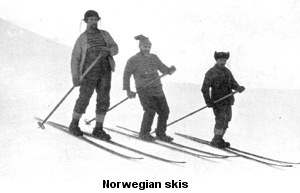
Many of the survey parties used Norwegian skis for cross-country travelling. The skiers only used one pole, which was common practice in Norway at that time.
Geology was very much part of the survey work on Laurie Island. Graptolite fossils were found on Graptolite Island west of Cape Dundas. Greywacke and shale of the Lower and Upper Silurian geological periods were found on Laurie Island, very similar to rocks found in the Southern Uplands of Scotland.
Laurie Island (like South Georgia) is entirely made up of sedimentary rocks. Bruce thought there might be links with South America and South Africa. Modern ideas of continental drift have proved this to be true.
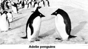
Millions of birds and many seals came to the South Orkney Islands in the spring. The seals were born at the end of September and by the end of October they had left their parents. Penguins returned to their rookeries, providing the Scotia crew with eggs and fresh meat. The adelie penguins came first.


| Glasgow Digital Library | Voyage of the Scotia | BRUCE | PEOPLE | SHIP | ANTARCTIC | INDEX |
|---|