| Glasgow Digital Library | Voyage of the Scotia | BRUCE | PEOPLE | SHIP | ANTARCTIC | INDEX |
|---|
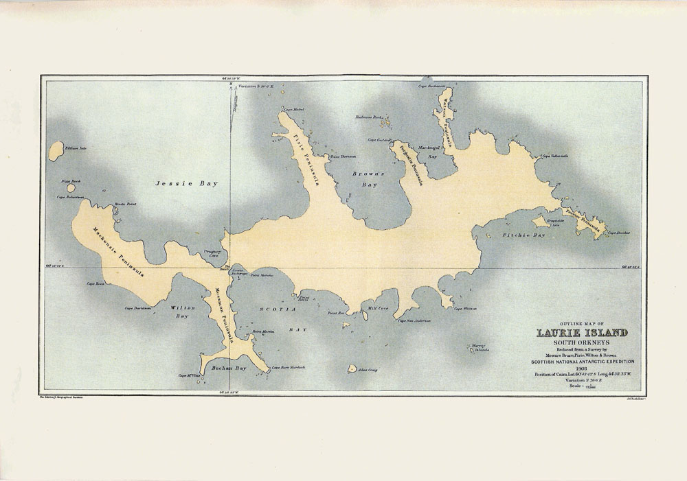
While the 1902-1904 Scottish National Antarctic Expedition was based on Laurie Island in the South Orkney Islands during the winter of 1903, the opportunity was taken to make an accurate topographical survey of the island, as existing maps had proved to be wildly inaccurate.
The resulting "Outline Map of Laurie Island" was printed by J G Bartholomew at the Edinburgh Geographical Institute and published in Volume 2 (1907) of the "Scientific Results of the Voyage of S Y Scotia 1902-1904".
As can be seen, many topographical features of Laurie Island were named after members of the expedition or persons otherwise connected with it, and several of these names have survived to the present day as the official names of their respective features.
| Glasgow Digital Library | Voyage of the Scotia | BRUCE | PEOPLE | SHIP | ANTARCTIC | INDEX |
|---|

