| Glasgow Digital Library | Voyage of the Scotia | BRUCE | PEOPLE | SHIP | ANTARCTIC | INDEX |
|---|
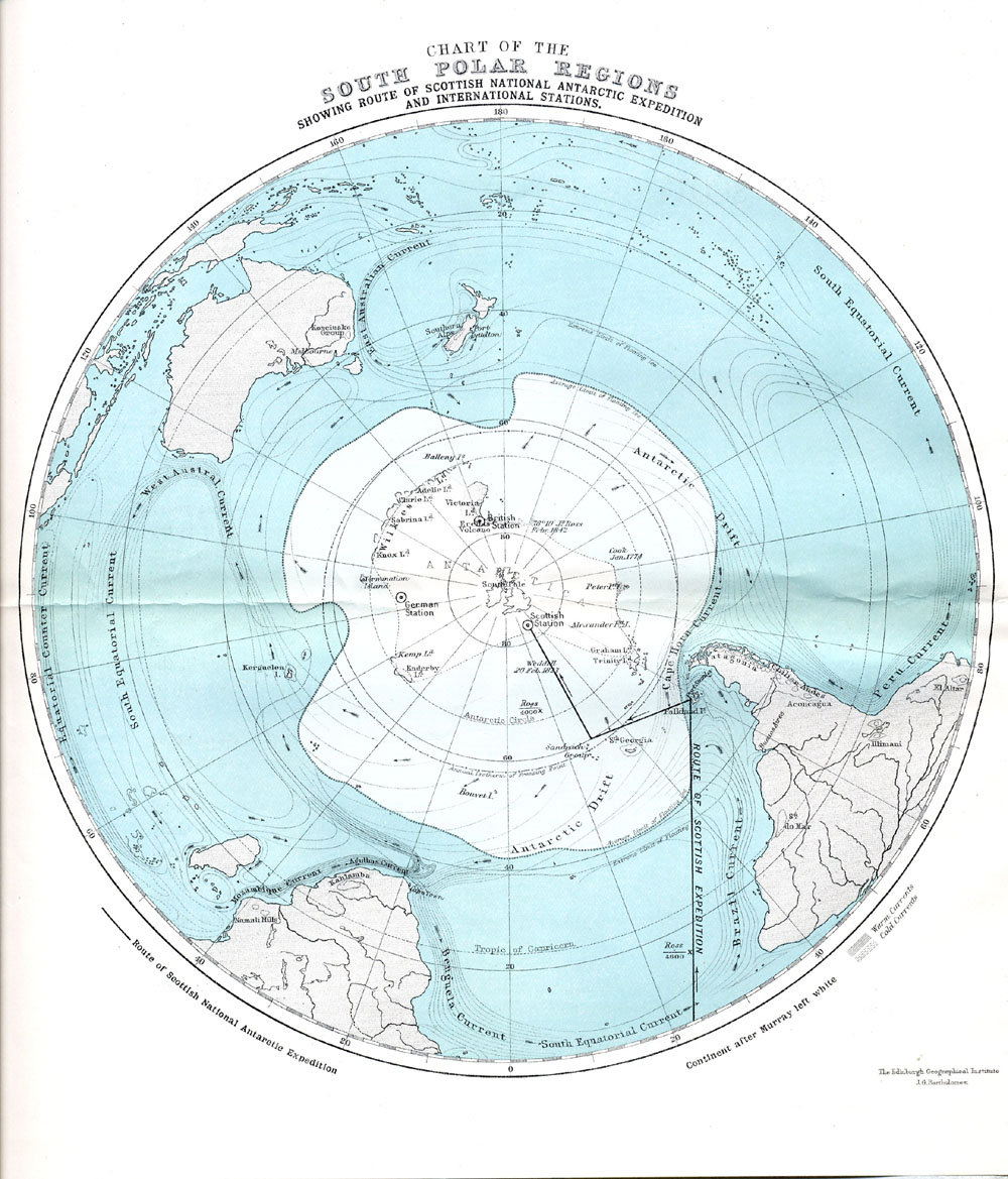
This "Chart of the South Polar Regions, showing the route of Scottish National Antarctic Expedition and International Stations" was printed at the Edinburgh Geographical Institute by J G Bartholomew and published in the printed version of the paper read by William S Bruce on 13 September 1901 at the British Association meeting in Glasgow (Doc-006).
The chart illustrates Bruce's expedition plans as they stood at that time, having been originally more ambitious but later truncated for various reasons, principally financial. Even these plans had to be modified to suit the conditions encountered in the Antarctic, as Bruce was more concerned with the safe and successful completion of the expedition than in rigid adherence to his preconceived ideas.
The chart showed that the proposed Scottish station would complete a triangle of stations around the South Pole, described by Bruce as "a condition very favourable and indeed almost indispendable for researches in meteorololical science".
| Glasgow Digital Library | Voyage of the Scotia | BRUCE | PEOPLE | SHIP | ANTARCTIC | INDEX |
|---|

