| Glasgow Digital Library | Voyage of the Scotia | BRUCE | PEOPLE | SHIP | ANTARCTIC | INDEX |
|---|
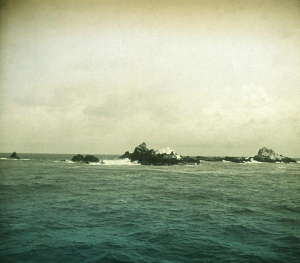
These remote rocks, with an area of under than two hectares (four acres), lie in the mid-Atlantic 870km (540 miles) off the coast of Brazil, just north of the Equator (0°55'N, 29°22'W). They were visited by the 1902-1904 Scottish National Antarctic Expedition vessel SY Scotia on 1 December 1902 during its southward voyage.
The highest point of the rocks is just 18 metres (60 feet) above sea level, but their base is over 3,650 metres (12,000 feet) below at the bottom of the ocean.
It had been hoped to make a landing, but the idea was abandoned after an abortive attempt during which Dr John H Harvey Pirie was swept into the sea by the strong swell and narrowly escaped an attack by sharks.
| Glasgow Digital Library | Voyage of the Scotia | BRUCE | PEOPLE | SHIP | ANTARCTIC | INDEX |
|---|

