Back to start | The Sea | Next
Seeing what's around

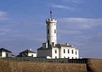
The first beacons or lighthouses were erected in the 17th century. The very first lighthouse, a coal-fired light, was established on the Isle of May in the Firth of Forth in 1636. They were located on particularly dangerous areas of coastline, either to guide boats in to a safe harbour or to warn them of dangerous rocks. The Northern Lighthouse Board was set up in 1786. It aimed to provide with a system of lights around the coasts of Scotland. The famous Stevenson family of engineers constructed many of these. As technology improved, the lights became more intense and reliable. By the 19th century there were many lighthouses on the East Coast of Scotland.
Radar

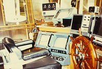
Even in these days of radar and satellite navigation, lighthouses are still important. Many are fitted with radar beacons or reflectors. This means that the equipment on board a boat can identify the position of the lighthouses.
The term Radar stands for RAdio Detection And Ranging. Radar relies on the pattern of reflection of radio waves when bouncing off various obstacles. Radio waves of a fixed frequency will travel at a constant rate through air so the time it takes for the reflection to reach the scanner can be used to measure distance. It allows fishermen to "see" landmarks even in poor visibility. It does this by providing an electronic reading of landmasses and obstacles. It uses this to create a picture of the area surrounding the boat. The fishermen can use this reading to identify landmarks on a chart.
The problem is that any vertical surface will give a reflection, even a wave, so "clutter" sometimes obscures the real obstacles. On the other hand, some surfaces such as low beaches, buoys, ice, or curved lighthouses reflect radar badly. These surfaces will not give clear readings unless fitted with a beacon. The displays can be confusing and need to be interpreted carefully. For example, a radar can suffer from blind spots caused by parts of the boat or other structures interrupting or distorting the beam. These can give false signals or can blank out signals from real obstacles. Seamen need to be properly trained in the use of radar and other navigational aids. They can them be very important tools in improving safety.
Sounding lead

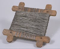
The danger of loss of equipment is also important. Early fishermen used a device called a sounding lead to help look at the seabed below their boat. A piece of lead was lowered over the side to the bottom. It showed the depth of the water, and any sediment that was found stuck to the tallow fixed to its base gave a clue to the nature of the ground (sand, mud or rock etc.). This was not very sophisticated though and obstacles could easily be missed.
Echo sounding

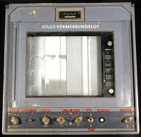
In the 20th century, echo-sounding was developed. This shows the depth and nature of the seabed. It can also locate any shoals of fish between the boat and the bottom. It works by sending and receiving sound waves to create a map of the seabed. Sound travels at a constant 1500 metres per second in water. By measuring the time between transmission and echo, the distance can be calculated.
It was first used in 1925 and further developed by the military during the 1940s. It was originally used to map the seabed, like an updated version of the sounding lead. However, it was discovered that the equipment was sensitive enough to pick up smaller objects in the water, such as fish. The fishermen can see the ground and whether it is sandy or rocky. This helps them to steer clear of rocky ground, when trawling for example.
Back to start | The Sea | Next